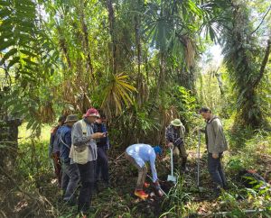
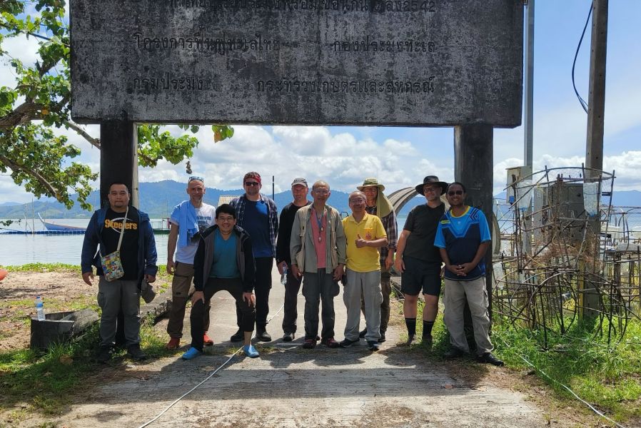
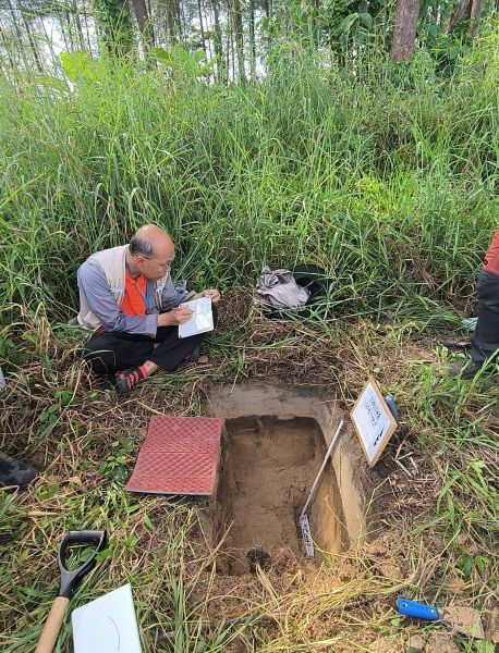
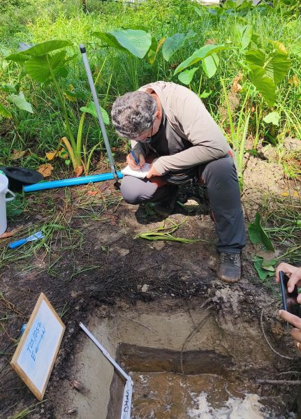
Interdisciplinary research is underway on the Andaman Sea coast, conducted by a team from Adam Mickiewicz University, Poznan, in cooperation with partners from the Department of Mineral Resources of the Kingdom of Thailand (DMR). Following the completion of study work and formal discussions on joint research in Bangkok, a 12-member research group travelled to southern Thailand for field research. The research is led by Prof. Witold Szczuciński (AMU Geohazards Research Unit) and former Adam Mickiewicz University, Poznan, doctoral student Supawit Yawsangratt (DMR). The aim is, among other things, to find answers to questions about tsunami deposits, which are crucial as they provide information about past tsunamis and improve our understanding of the frequency and potential magnitude of future waves.
The past decades have brought us many examples of catastrophic events whose consequences could have been significantly less severe if geological data had been used appropriately. For example, the Jōgan tsunami of 869 in Japan was similar in size to the 2011 tsunami (known from the Fukushima disaster), the effects of which were also studied by researchers from the University of Adam Mickiewicz, Poznan. The sediments (sand, boulders, etc.) left behind by the catastrophic event of 869 served as a potential warning, which in 2010 began to be considered in future changes to coastal development plans and tsunami risk assessments. Unfortunately, the tsunami struck before these changes could be implemented.
Before 2004, paleotsunami evidence in Thailand and Indonesia was largely unknown, resulting in a lack of early warning and catastrophic consequences. The team’s research seeks to address these information gaps, with the goal of enhancing disaster preparedness using geological records.
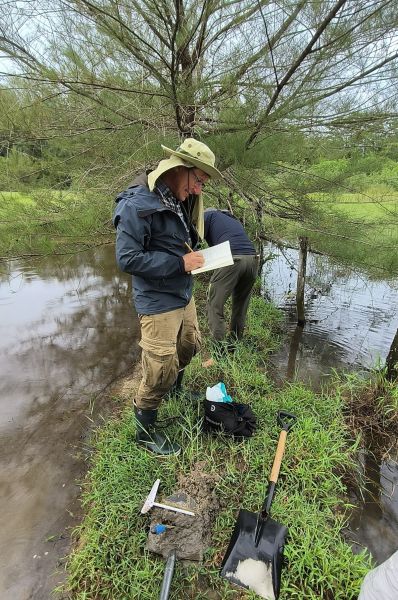
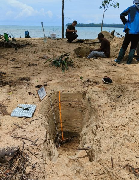
Research conducted by a Polish-Thai team aims to help use the geological tsunami record to reduce the potential effects of tsunamis in Thailand and other countries. After 20 years, the sediments left on the Thai coast in 2004 are often physically and chemically altered, sometimes leaving no trace. Researchers are documenting their state of preservation to estimate how thick the sediment layer must be to be preserved and what part of the area originally flooded by the tsunami retains evidence of the disaster. The team is also collecting sediment samples to assess the long-term impact of potentially toxic elements (e.g., arsenic) that arrived on land with the tsunami sediments and may now be affecting local plants and animals, as well as the people who consume them.
The project focuses not only on tsunami deposits but also on the geological traces of typhoons on the coast of Thailand. Tsunamis are usually generated by earthquakes, while the trajectories and strength of typhoons (cyclones) are a consequence of climate change. Distinguishing between traces of sea flooding caused by tsunamis and typhoons is challenging, as the sedimentological characteristics of these phenomena can be very similar. These traces are highly relevant for risk assessment, but in the case of typhoons, they also provide a basis for evaluating the impact of climate change on the extent and intensity of these extreme events. By analysing typhoon sediments, their characteristics and behaviour, researchers hope to identify the main diagnostic features that distinguish them from tsunami sediments. This is also the main objective of the TSUNASTORM project (led by W. Szczuciński), under which this research is being conducted, funded by the National Science Centre.
Recent fieldwork on Phra Thong, Kho Khao, and near Bang Mor documents both historical and recent sediment layers. These efforts are focused on improving our knowledge of tsunami and typhoon effects along the coast, serving the broader goal of using geological evidence to inform and protect vulnerable communities.
photo by R. Jagodziński